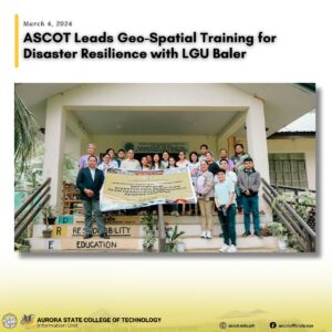
March 4, 2024-ASCOT School of Forestry and Environmental Sciences (SFES) has kicked off the “Geo-Spatial Solutions for Resilience: Empowering Disaster Risk Reduction Team through GIS and Remote Sensing” training program. This comprehensive workshop, running from March 4 to March 15, 2024, aims to empower the Baler municipal disaster risk reduction employees through the application of Geographic Information Systems (GIS) and remote sensing technologies.
Dr. RB J. Gallego, Dean of the School of Forestry and Environmental Sciences, warmly welcomed participants and highlighted the significance of the training in addressing the pressing challenges posed by natural disasters.
Dr. Eutiquio L. Rotaquio, Jr., a college professor, provided insights into the practical applications of GIS in environmental conservation.
Dr. Ma Luz F. Cabatan, the Acting Vice President for Academic Affairs, expressed optimism about the training’s transformative impact on disaster response efforts.
Representing the Municipal Planning Development Office of LGU Baler,Mr. Richard F. Rutaquio reaffirmed the local government’s commitment to supporting initiatives promoting disaster resilience.
ASCOT President Renato G. Reyes emphasized the college’s dedication to innovation and its mission to serve the community.
The resource speakers are SFES faculty members including John A. Suniega, Wandeg C. Diguinat, and Marlon Lingon.
Throughout the sessions, participants will acquire knowledge on topics such as Introduction to GIS, Advanced Mapping Layout, and Land Cover Analysis.
In collaboration with LGU Baler, ASCOT continues to lead the way in leveraging technology for the betterment of communities.
#ascot #GIS #SFES #mdrrmo